 5 days / 4 nights
Marrakech
Mount Toubkal Trek, 5 Days: Summit and Berber Villages
Summit Jebel Toubkal at 4,167 m — the highest point in North Africa
- 2–10
- Challenging
- 11 Oct
From€395 / per person
View tour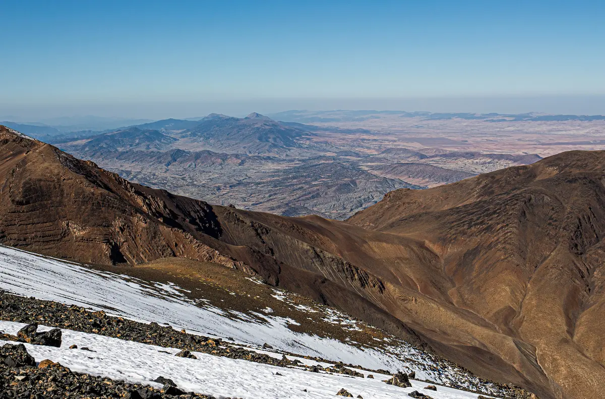
Marrakech-Safi / Drâa-Tafilalet
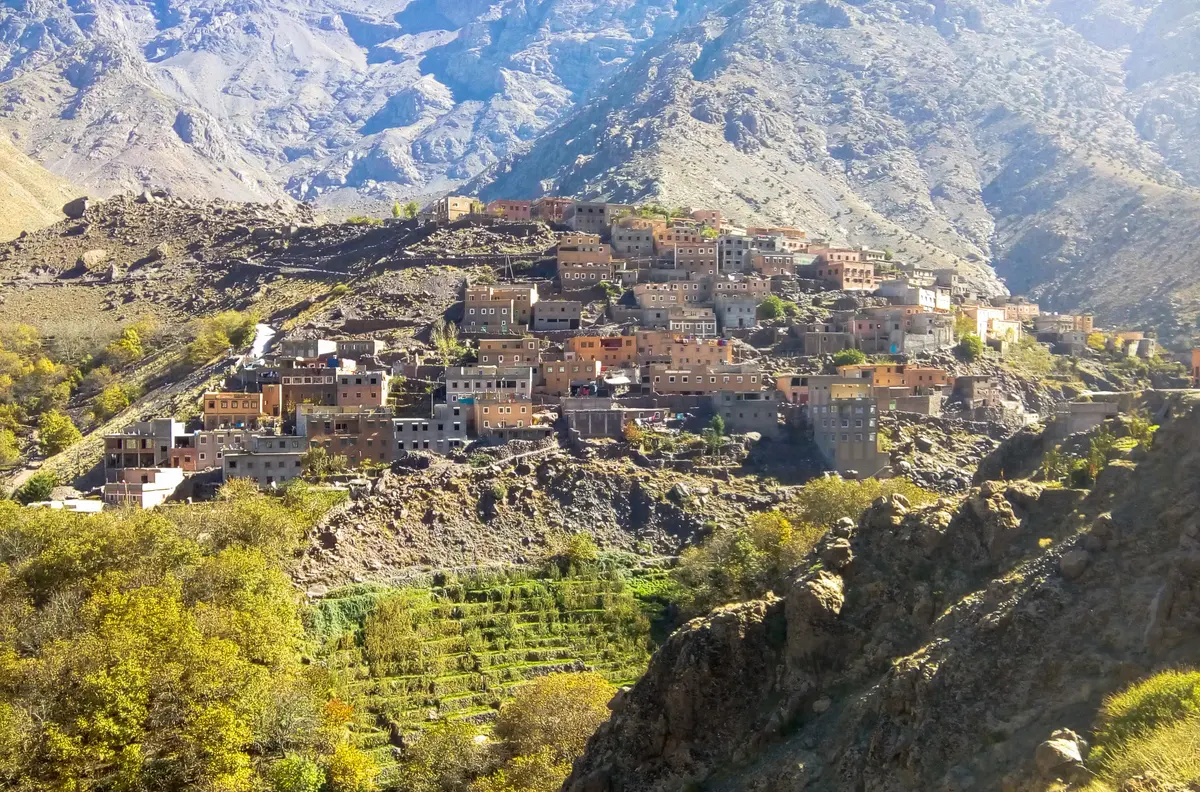
Snow, walnut terraces and Berber villages, ninety minutes from Marrakech
Best time to visit
April to October for trekking. December to March for snow and lower valleys.
How long to stay
A day trip works. Two nights in a village is far better.
Getting there
Imlil is ninety minutes from Marrakech by road. The Tizi n’Tichka pass to the south takes two and a half hours.
The Atlas Mountains in Morocco run across the middle of the country, and the High Atlas is the highest section — it holds Jebel Toubkal at 4,167 m, the tallest peak in North Africa. The nearest trailhead is ninety minutes from Marrakech.
Most people book a trip to the Atlas Mountains without realising how big the range is. The Atlas system runs about 2,500 km across North Africa, and the Moroccan section holds every peak above 4,000 m on the continent north of Kilimanjaro. It is what makes the country work: the mountains catch the weather, the snowmelt feeds the oases on the far side, and everything green in the south is downstream of a ridge.
For a visitor the useful fact is proximity. You can leave a riad in Marrakech after breakfast and be at 2,000 m by mid-morning with a mule carrying your bag.
The range is the High Atlas in English and the Haut Atlas in French, which is what almost every map sold in Morocco uses — along with Maroc for the country. Worth knowing before you buy one.
The peak is written Jebel Toubkal, Jbel Toubkal or simply Toubkal. The people are Amazigh; “Berber” is the older external word and you will hear both, including from Moroccans. And a gîte d’étape is a village guesthouse — the phrase appears on signs and doors long before the English word does.
The range keeps going long after the Marrakech day trips stop. Todra Gorge — 300-metre walls about ten metres apart — sits in the eastern High Atlas on the main road to the desert, and is the single most photographed thing in the whole range.
They are not interchangeable. Each has a different difficulty and a different reason to go.
| Valley | Drive from Marrakech | What it is |
|---|---|---|
| Ourika | 1h | Easiest, greenest, busiest at weekends |
| Imlil | 1h 30 | Trailhead for Toubkal and the serious walking |
| Tizi n’Tichka | 2h 30 to the pass | The drive south, not a walking base |
Anyone combining Marrakech and Atlas Mountains days on a short trip should take Imlil. Ourika is better if you want a river, a waterfall and lunch rather than a walk.
An hour from the city, and the valley Marrakchis use themselves. The road follows the river past cafés with tables actually in the water, argan and saffron cooperatives, and terraced fields, to Setti Fatma, where a chain of seven waterfalls climbs the hillside.
Two honest warnings. Fridays and weekends it is full of families from the city, which is charming or crowded depending on your mood — go on a weekday. And the Ourika floods. Storms high in the mountains can send water down a dry riverbed within an hour, and it has killed people. If the sky is black upstream, do not sit in a riverbed café.
Imlil sits at about 1,740 m at the head of a walnut valley, and it is where the mountain trade happens: guides, muleteers, gear shops, and a dozen village houses taking guests.
From Imlil you can do a two-hour walk to a neighbouring village and back, a full day over a pass, or the Toubkal ascent proper. The summit is a two-day trip at minimum — up to the refuges at around 3,200 m on day one, summit and descend on day two — and three days is more comfortable, with better odds of not being wrecked by the altitude.
There is no technical climbing on the normal route. There is a great deal of steep scree, thin air and, from November to April, snow that makes it a genuine winter mountain needing crampons and an axe. A certified Moroccan mountain guide is required, and mules will carry your bags to the refuge.
We run it as a five-day Toubkal summit trek with acclimatisation built in, which is the version that gets most people to the top.
On the northern side of the range, about two and a half hours from Marrakech: a 110-metre fall in three tiers, a path down through olive terraces, boats at the bottom, and Barbary macaques in the trees along the way. Do not feed them.
It is a full day and a completely different landscape from Imlil — green, wet and busy. Good with children.
This is the part we push hardest, and the part people remember.
A gîte is a family house. You get a simple room or a mattress in a shared one, blankets instead of heating, a shared bathroom, and a tagine that has been cooking since the afternoon. Bread comes out of a communal oven. In winter you eat around a brazier.
The villages here speak Tashelhit, one of Morocco’s Amazigh languages, before they speak Arabic or French. Hajar’s Darija and her contacts in these valleys are the reason we can put people in houses rather than hotels — this is not something a booking site arranges.
Two things to know before you go. Alcohol is not part of village life and should not be brought into a family house. And you will be offered tea repeatedly; accepting once is polite, and refusing every time is not.
You do not need to be fit to enjoy this range. The options are genuine and graded:
The mule is the point. Nobody carries anything here unless they want to.
April to June is the best trekking window: wildflowers, snow still on the peaks, rivers full. September and October are dry, stable and warm. July and August are hot down low and fine up high, and the valleys fill with Moroccan families escaping the cities. November to March brings snow above about 2,500 m. The lower valleys stay walkable, the light is superb, and the villages are cold — bring a proper layer, and see what to pack.
The Tizi n’Tichka pass closes occasionally in December and January, sometimes for a day. If your route to Ouarzazate and the desert crosses it in midwinter, build in a margin.
The Tichka crosses the range at 2,260 m and is one of the great drives in Africa: two hours of climbing out of Marrakech, a pass, then the descent into dry red country on the other side. Four hours to Ouarzazate, honestly measured.
It is also the road to the Sahara. Most people cross it without stopping. It is worth an hour at the top and a walnut-oil stop on the way down.
The mountains are the easiest thing in Morocco to add to an itinerary and the first thing most people cut. We think that is backwards. See the rest of the country on our destinations page, then tell us how many days you have.
The High Atlas runs west to east across the middle of the country, separating Marrakech and the Atlantic plains from the pre-Sahara. The nearest trailhead, Imlil, is about 65 km south of Marrakech — an hour and a half by road.
Yes, and it is the best single day out of the city. A standard day covers the Ourika valley or Imlil, a two to three hour walk, and lunch in a village. You are back in Marrakech by six. Two nights up there is better, but a day trip is not a waste.
No technical climbing, but it is 4,167 m and the ascent from the refuge is a long, steep scree walk at altitude. Two days is the minimum and three is more comfortable. Between November and April it is a winter climb needing crampons and an ice axe.
Yes. An accredited Moroccan mountain guide is required on Toubkal, and in winter it would be reckless without one anyway. Guides are arranged in Imlil, mules carry the bags, and the refuge below the summit must be booked in season.
Yes. The villages are hospitable, guided trekking is well organised and the paths are well used. The genuine risks are weather and water — altitude, cold nights, and flash floods in the valleys after summer storms. Go with someone who reads the sky.
A gîte is a family house with simple rooms or mattresses, a shared bathroom, blankets rather than heating, and a tagine cooked by the family. It is not a hotel and it is the best night most people have in Morocco. Bring a warm layer.
Snow lies on the high peaks from roughly November to April, and the Tizi n'Tichka pass occasionally closes for a day or two in December and January. The lower valleys stay walkable all winter, and the light is at its best.
About two and a half hours north-east, on the far side of the range from Imlil. It is a full day out with a walk down to the pools, Barbary macaques in the trees along the path, and boats at the bottom of the 110-metre falls.
5 days / 4 nightsMarrakech
Summit Jebel Toubkal at 4,167 m — the highest point in North Africa
From€395 / per person
View tourTell us your dates and interests. We reply personally, usually within a couple of hours.
usually within 2 hoursNo deposit to planLicensed tour guide
+212 665 295 999
Try “Sahara”, “3 days”, or “Chefchaouen”.